Monday, July 14, 2014

That's all folks... (for now, at least)

ENDURANCE gets hauled for lay up at Baltimore Marine Center.


See you in the Spring.  And thanks, all, for a great Winter Season.

Wednesday, May 28, 2014

What have we been doing in Baltimore?

Well, we cleaned off our old teak, …


And turned it into this -


And just in time to avoid this,…


We are happy to be done with teak.  

And happy to have Ali visit, as well!


Wednesday, May 21, 2014

Norfolk to Baltimore - with a side trip to The Big Easy!

Our Monday, May 5 arrival in Norfolk (actually Tidewater Yacht Marina in Portsmouth, across the Elizabeth River from Norfolk), was a day or two earlier than even we had planned.  We had expected an eight day ICW run to Norfolk but arrived on Day Seven.

By 11:00 on Day Eight, we were in a rental car and on the road to New Orleans for a Mothers Day Weekend baby shower. At about 1,000 miles from Portsmouth to NOLA, we were going to cover that distance in two days.  That same distance (Key Largo to Portsmouth) took us ten days by boat.  And three of those days were counted at 24 hours each!

It was good to tie up, close up and walk away for a bit though. We have been on the water non-stop (mostly) since August 22. Our road trip would take us through Virginia, across North Carolina and South Carolina, then Georgia and Alabama, and finally along the Mississippi Gulfcoast into Louisiana. A good chunk of the Old South.

As we approached Colombia, South Carolina we realized we might be able to snag a couple of USC Colombia professors and their precocious four year old for a dinner date. Alas, four year olds and their parents eat dinner early. But we did stop by their house for a nice hour long visit and demonstration of Issac's electrical engineering skills.  It was so great to see Ellen and John and Issac even for that short time. A taste of home.


Group shot!

An overnight en route and into NOLA in time for dinner with Charlie and Tabby on Wednesday. Nice to really be "home" again. Thursday and Friday were work days for all of us, but what a great time to catch up and relax and be a family. With Katie's arrival from Baltimore and Joe & Mary Margaret from Austin on Friday evening, it was just like old times. And all excited for our soon to arrive first grandchild! Truly a memorable Mothers Day for all of us.


Charlie test drives the Drone.
Last time indoors (we hope)!


Charlie & Andrew get the Drone up and running in Audubon Park.


There she goes,….


Great control.


View from the Drone.

By the following Tuesday we were back in Portsmouth. A stop for dinner in historic Madison, Georgia where there are over 200 antebellum homes untouched by Sherman's Ride to Atlanta. Apparently, Sherman had a West Point classmate who's brother was a pro-Union United States Senator from Madison, and in deference to his classmate and the Senator, Madison was spared the Scourge of the South. Beautiful town!


Madison, Georgia.

Though there was a fleeting thought of leaving Portsmouth upon arrival on Tuesday night in order to take advantage of the weather and beat an expected Thursday night cold front (it is usually a three day trip up the Chesapeake), some well deserved sleeping overruled that thought. Nevertheless, we were off by 8:30 Wednesday morning despite the fog in the Elizabeth River. That fog got worse two hours later as we approached the mouth of the Bay (at which time our radar stopped working). We decided to pull into the harbor at Willoughby Bay near Ft. Monroe and wait for the fog to lift. I used that time to check connections on the radar and found nothing that looked out of place. A call to the manufacturer (in Merrimack, NH) got a technician on the phone for some troubleshooting. The diagnostics he ran with me showed no electrical or electronic issues, so he concluded that we had a mechanical problem. Most likely, he thought that the belt that turns the rotor in the radome (45 feet up the mast) had slipped. Not being in a position to climb the mast, we waited out the fog until noon.

Back on the Bay, the fog was coming and going. NOAA expected bad fog in the Lower Bay that evening, so we decided to make as much headway as possible and do a 20 hour overnight to Baltimore.  

Despite the fog, it was an un eventful passage. We kept to the Western Shore out of the main traffic lanes and channels. We also benefitted from AIS ship reports throughout the night from Hayden on s/v Island Spirt, another Island Packet. We only "saw" one of the she so reported, and only barely. We never saw the Bay Bridge in Annapolis until we were just about under it at 6:00 AM.


This "NH" is not New Hampshire, it's North Harbor in Baltimore.


Coming into Baltimore the fog cleared and the Francis Scott Key Bridge was clearly visible from almost two miles away! By 9:30 we were snugged up in Slip C13 at Anchorage Marina. 


Pride of Baltimore.

Essentially our second home.

Tuesday, May 6, 2014

Making up those lost miles….


Our Minim Creek Anchorage.

Sunday was not a day of rest.  We left Pungo Creek at 0655 and made it all the way to Buck Island in the North River.  Close to the North Carolina/Virginia border and an 80 mile day in all!  We can almost see the barn from here.


The calm before that THUMP!
Well past that now.

And it was an eventful day, as well.  If Saturday was a day for long pants (the first since January) and a winter coat (where was that stowed?), Sunday had warm socks and hot oatmeal for breakfast added.  How do people survive in these frigid climates?  It was 58 degrees when we got underway! BRRRRRR!!

We did some pretty fast sailing in the Alligator River and then again up the North River in howling winds as high as 26 knots.  That helped us accomplish a lot of miles before we anchored at about 5:45 PM.


Sail Up and speeding along.

Even though we missed an Alligator Bridge opening by a mile and a half, the most excellent of Bridge Tenders gave that a no never-mind and opened for us as soon as we made it to the bridge.  No bridge delay at all.  That makes for a good day.


All of the Aids to Navigation host Osprey nests with baby chicks.

And who should we see in the Alligator River/Pungo River Canal?  Our friends from s/v Messenger? s/v Autumn Borne? s/v Painkiller? s/v Last Boat? s/v ANYTHING? No, no, no, a thousand times NO!

It was my arch nemesis.  ROYAL ENGINEER!  Tug and barge.  Narrow canal. Again!!


Harmonic Convergence?

This time, I had a plan.  We cranked it up from 2800 RPMs to 3200 RPMs.  We shook a bit.  But we passed Royal Engineer without incident.  


Passing Lane.


You can't script this stuff.

And we kept that motor revved up for the next twenty minutes in order to put distance between us.  We did not see that monster again!


Until we meet again?

Blowing stink, as one would say, when we got to Buck Island.  But we were content.  Anchored in 10 feet of water with 90 feet of chain.  Within inches of where we anchored in October 2013 on the way back from the Bahamas.  Let it blow.

Monday, May 5, 2014.  A business day.  All business.  


Depth perception issues without contacts.

We have only 56 miles left to reach our Mile Marker Zero destination.  But; .. and that’s a big BUT.  We cross into Virginia at Mile Marker 36 after crossing the narrow and blustery Currituck Sound.

We then have the North Landing Bridge at Mile Marker 20 opening on the Hour and Half Hour.  No problem.

Next, we have the Centerville Turnpike Bridge at Mile Marker 15 opening on the Hour and Half Hour.  That’s five mile for us to make in 30 minutes.  A tough slog for which I planned to use my Royal Engineer stratagem (3200 RPMs).  But,… we are immediately foiled by a Montreal Motoryacht that apparently takes “no wake” seriously as they virtually stop as they move through the bridge and for the next what?! Mile??  We are delayed a half hour at the Centerville Turnpike Bridge.

The Great Bridge Bridge (no typo there) is at Mile Marker 12.  Only three miles away and opening only on the Hour.  We make it by jumping ahead of m/y Montreal.  Other sailboats in our line (four or five by now) have also caught on and pass this rule follower.

We make it into the Great Bridge Lock at Mile Marker 11.5 ahead of the pack.  That means we can run to the Steel Bridge at Mile Marker 8.8 to make the next on the Hour opening?  No such luck.  A bridge delay again. 

Tess calls the last bridge.  The notorious Gilmerton Bridge.  Well known for being in the closed position from 6:30 AM to 9:30 AM and again from 3:30 PM to 5:30 PM.  Talk about bridge delays!!  Tess’ question?  Can you confirm that you have a 4:00 opening as well as a 3:30 opening?  We know the answer.  No.  It’s 3:30 or 5:30.  It’s Mile Marker 5.8.  Only three miles, but since we left the Great Bridge Lock we are now in Virginia Tidewaters.  That means, we are fighting a real tide again.  Yikes!

Royal Engineer stratagem.  We outrun the pack.  We make the Gilmerton with four minutes to spare!  We are good.  We are there. 

We mosey down the Elizabeth River.  Norfolk on one side.  Portsmouth on the other.  The rain starts.  The wind picks up.  But, we are almost there.  Tidewater Yacht Marina.  Portsmouth, Virginia.  Mile Marker Zero.  Slip F24 (only three slips in from the end).  No problem.

Problem.  With the wind pushing the bow one way and the current pushing the stern the other, I miss the turn into the slip.  Back and fill.  Back and fill.  Back and fill.  No progress.  Head down the slipway and make (or try to make) a turn.  Again.  Back and fill.  Back and fill.  Back and fill.  Finally!

This time, heading into both the wind and current, we slide into F24.  Only one post bumped.  But that’s what they are for.


We are fried.  Frazzled.  But safely ensconced.  1,200 plus miles in nine days.  But, home.  Or close enough to feel like home. 

Sunday, May 4, 2014

When we last spoke...

When last we spoke...

Arrived at Charleston and anchored at 0500 on Tuesday.  Three good hours to catch up on sleep and then the coffee was made. Looked across the the anchorage and was surprised to be looking at s/v Dalmatian (Tom & MaryLou) from Durham, NH!! They stopped by at about 0900 to say "hello" as they headed to a medical clinic to check on an odd bug bite that Tom had (and rightly feared might be dangerous - any injury on a boat can get infected really quickly).

We hope Tom is all right since we left Charleston at 1030 without further adieu.  A tender from a Megayacht on the Megadock came over to inform us that his MegaCaptain believed we were dragging. We weren't, but as the tide and wind changed we did swing into the channel a bit (150 feet of chain at 5:00 in the morning after three days offshore; it's hard to judge where you might end up!). Rather than move, we decided to leave. Hard to pass up Shrimp & Grits in Charleston, but we know we'll be back.

We made great time across Charleston Harbor and into the ICW. Our very first Lift Bridge was, thankfully, "on demand". Tuesday night was spent in Minim Creek, one of our favorite ICW anchorages.  Marsh and shore birds galore, fish jumping, tall reeds giving us a protected, secret garden feeling. Just nice.  Next morning, we glided past Georgetown SC and put our head sail,out to add a boost into the beautiful Waccamaw River.  Scenic as a State Farm calendar!

Our second night was in Calabash Creek on the South Carolina/North Carolina border.  One of our least favorite ICW anchorages. Too narrow. Too shallow. But our third time here.  We ran aground entering the Creek. Rookie mistake. Must be too tired. But we managed to back off and take the proper route into the Creek.  Only one other boat there. Great! Plenty of room.  But, dead low tide.  Be careful.  Anchor down.  We stop. Sideways. Aground again. Is a pattern developing?  We negotiate off our shoal and try again.  Hope the neighbors aren't watching (who wouldn't?).  This anchorage is more like stopping to sleep in a local 7-11 parking lot. All the charm of a place to sleep and nothing more.

We were successfully anchored by 5 PM. And, one of us at least, in bed by 8:00.  Two groundings within ten minutes is enough for some.  That one was up by 4:00 AM and calculated that, to assure a favorable tide in the Cape Fear River we needed to be on the road (so to speak) by 0545. An alarm was set for 0530.  At which time it remained extremely dark. Another alarm for 0545. And we were off anchor by 0615.

The plan worked! We needed to clear the Cape Fear River and get into Snow's Cut (which leads us back into the ICW proper) by 12:30 in order to avoid the ebb tide in the River. We actually hit the ICW at 12:15 even with our 30 minute morning delay. That felt great!  "Delay"?!?  Did he really just say a 6:15 departure was a Delay???

And once in the ICW we had a Southerly ocean breeze so we again put up the headsail and added an extra knot (at least) to our motoring speed.  It felt good to be a sailboat again.

Wrightsville Beach Bridge opening at 1500. Figure Eight Bridge opening at 1600. We were on a tear! Until 1615. Hard aground with a "THUMP". We went from a consistent 12 foot depth onto a 4 foot deep shoal in an instant. No warning. Black Mud Channel at Green 99A. No way to motor or sail off. "Oh, yeah", says SeaTow. "You'll be our second or third one today at that spot".

We were off again in an hour, but too exhausted to proceed much further.  Luckily we were within a few miles of Harbour Village Marina in Hampstead, NC and Mike, the Harbormaster, was still there when we called just before 5:00. We re-fueled and then pulled into a slip. Hot showers. Italian Restaurant dinner delivered to the boat. And we made 75 miles that day. Not bad, even with the bumpy ending.

The irony of the grounding is that when it happened I was on the phone with my marine insurance broker (talking about another customer's issues). When THUMP happened, I threw the phone down, let the headsail sheet fly from the winch and jumped up to see where we were. Five minutes later I remembered the phone and called the agent back (after calling SeaTow) to explain the sudden chaos and disconnect. New Rule: Never talk to a boat insurance agent when the boat is moving.

Friday brought us to Swansboro after a slow day with adverse currents (never even reaching a 6 knot boat speed) and more scary, shallow shoals (including one bump). Damn Spring Tides! We were spent by 3:00 PM and happy to start napping at a secure anchorage. Only 38 miles, but we'll make it up somewhere.  He says "napping"...

Well,...we did get a good night's sleep. Like, from 4:00 PM to 6:00 AM. each with a short break to grab a small bite to eat.

But, we were off the anchor at 6:25 to take advantage of the Bogue Sound tide. A long way to Morehead City, but we made the Neuse River by 12:15. The Neuse was dead calm and glassy, but with a favorable tide giving us 7 plus knots. That meant we had up to another 7 1/2 hours of daylight! And that took us all the way across the Pamlico River and up the Pungo to Belhaven. We were at anchor in Pungo Creek by 6:30.  A long day, but still well rested. Also, a 93 mile day. Making up for short-changing Friday.

No good cellphone or internet reception here. But Norfolk looks like it's only two days away.

Tuesday, April 29, 2014

A Pleasant Vist followed by a Northern Passage

[Written Sunday morning, April 27]

On Tuesday afternoon we arrived at the Pumpkin Key West Anchorage and dropped the hook at about 3:00 PM.  


A Favorite Spot.

That gave me time to dive on the Prop and scrape off barnacles. We've been motoring fairly slowly (not much above 6 knots even at 2800 RPMs) and with quite a bit of cavitation, which I attribute to a fouled prop, a barnacled hull and the shallow water of Biscayne Bay. At least I can try to do something about the first two.

My Tuesday sojourn under the boat allowed me to clean the Prop and the Rudder and the back end of the boat fairly well.  I also did the Starboard side hull as far as I could reach without going under. Doing this while snorkeling is exhausting on the arms, shoulders and stamina. 


Pumpkin Key Evening.

Early Wednesday morning I was at it again. This time with a full wetsuit (thank goodness for my new weight belt). Using a long handled deck brush I was able to get both sides of the hull all the way down to the keel before giving out. And that was done in two jaunts separated by an 0930 nap.

When not under the boat, the anchorage at Pumpkin Key is among our favorites. Unfortunately we had a cold front from the West on Tuesday night so it was a bit bumpy. But I did see my first Iridium Flare at 2104:31 (that's the time it was visible - for almost three seconds!). I had missed one by one minute at 0639. My Flare was Iridium 90. That's the name of the satellite. Iridium is the satellite phone company and they apparently have dozens of satellites up there. When a satellite passes by, if it's solar panels catch the Sun just right, it looks like a flare. In my case, the satellite seemed to appear as if a light switch was turned on. It grew brighter for a few seconds and then just completely disappeared. Since I have been chasing this phenomenon since first hearing about it on the Boot Key Harbor Cruisers Net, I thought it was pretty spectacular. You can download an App for this called "Iridium Lite". Pretty cool!

At about 3:00 Wednesday, yet another jet landed at the Ocean Reef Club Airport. Soon thereafter we had a call from Jane & Bill Exner who arrived in that (private) jet to spend the week at ORC. We pulled the anchor up and headed into the private channel to ORC. We had previously taken the dinghy in to find the house that Jane & Bill would be staying in and to check the depths of the approach, the channel, the turning basin and dockside (Mark Twain style with a heavy zinc at the end of a marked off line). 


We found the House.

We never saw less than 7 feet with this investigation and that proved fairly reliable as we slowly motored in at near high tide, made a three-point turn in a very narrow residential canal, and sidled up to the dock to hand off lines to Bill & Jane.


And found the Dock.

Oh! To be plugged in again. The batteries loved it.

And to see Jane & Bill again? Even better.  Our human batteries loved it!


Home really is where the heart is!

We certainly took advantage of their spacious retreat and gracious friendship for a few days.  Most of it lounging about, catching up and (for us) being "home" again with great friends.

Friday the four of us took a bit of a Day Sail out of ORC and into Card Sound. We motored West in dead still waters until we were under the Card Sound Bridge (connecting the Keys to mainland Florida at or South of Homestead). Once into Barnes Sound the wind seemed to pick up so we loosed the sails and let her fly. At no more than 3 knots, though.  But at least we went sailing.  

We tried to make it to our "off reef" sunset watering hole of the evening before, but chancy weather kept cool heads. Gilbert's Resort, you're a Bill Exner kind of hole.


Anticipation.


The View from Gilbert's.


Tiki Heaven?


Now, we're tourists!


Ahhhhh……..

Tess and I had been listening to Chris Parker's weather forecasts for the past few days in anticipation of jumping offshore to Charleston as we headed homeward. The plan was to leave ORC for Ft. Lauderdale (leisurely over Saturday & Sunday), then pick up my brother George as crew for a 3 1/2 day passage to South Carolina starting Monday night or Tuesday morning. That meant arriving at Charleston  on Friday. But, Chris Parker identified for us a large cold front moving across the Plains States and due to arrive at the coast on Wednesday night. Too soon to tell where it would end up, but there would be significant risk of it getting bigger once it reached the Atlantic. What to do? What to do?

With this info available (as of Saturday morning, we would not get a reliable update until Monday), we decided to take advantage of the benign weekend weather and just head North.  As a result, we left OCR at 0930 and headed from the Bayside to the Oceanside via Angelfish Creek (depths as low as 6.6 at dead low tide). 


Fond Farewell.

It was then North (actually East) up Hawks Channel toward Miami. Our first proposed destination was Ft. Pierce but once we left Hawks Channel crossing the Reef and got into the Gulf Stream (about 12 NM from shore), we were flying at an average of over 9.5 knots.  We adjusted our plan for Jacksonville expecting an arrival on Monday morning with the possibility of George meeting us there via Southwest Airlines on Monday night.


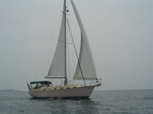
Saturday Visitor.  Ended up inside the cabin for a few hours.

We did have a bit of a lumpy Saturday night heading NNE into swells of sometimes five feet and wind mostly on the nose, but we did make real progress. Sunday morning (after two hour watches through the night), we were well past Ft. Pierce, but a fuel supply calculation indicated that we we might arrive at Jacksonville with as little as 9 gallons of fuel to spare.  Too close for our comfort!  

At 0615 we diverted to the NW toward Cape Canaveral about 30 NM away.  We'll refuel there (at least 100 gallons) and then either head back out toward Jacksonville (a late afternoon Monday ETA), or make another plan.

Stay tuned...

[Added Sunday afternoon]

Well, before this was posted, we progressed. Arrived at the Cape Marina Fuel Dock at 2:30 in the afternoon and off again by 3:05 after adding 91.88 gallons of diesel fuel to top off the tank.  Port Canaveral is a busy place on Sunday. Not like Miami at least to the extent that there was no music blaring from every boat. And all were manageably sized recreational fishermen; no mega yachts. It was good to have a chance to go in for the first time without worrying about the bridge opening and lock transit needed to access the ICW from here.

By 5:00 PM we are out of the long Port Canaveral channel, around the shoals and on our third waypoint. Next waypoint is 255 NM away at the entrance to Charleston Harbor. Comfortably motor sailing with Main and Jib we are doing 8.1 knots in a Northeast breeze with the sun about to set behind is. Very, very nice.


Sunday Visitor.  Everyone is heading North.

[Added Monday morning, April 28]

A rather pleasant night in the Florida Strait and the Gulf Stream. A nice current had us moving all night at about 8.5 knots motor sailing in light Easterly winds with the Main and Staysail. I don't like to have the large Jib up at night with a shorthanded crew. We are on single handed watches with two hours on and two off. Between 0600 and 0700 we were reacting to a pronounced wind shift to the South. We ended up with just the Staysail up for stability since the wind is very light and right on our stern. We could run up the Light Air Sail, but it hasn't seen daylight in more than a couple of years and would result in work we are not anxious to do.  Besides, we are on a delivery of sorts, trying to beat the weather on Wednesday night. And, as of 1000 this morning we are motoring at almost 9.5 knots.
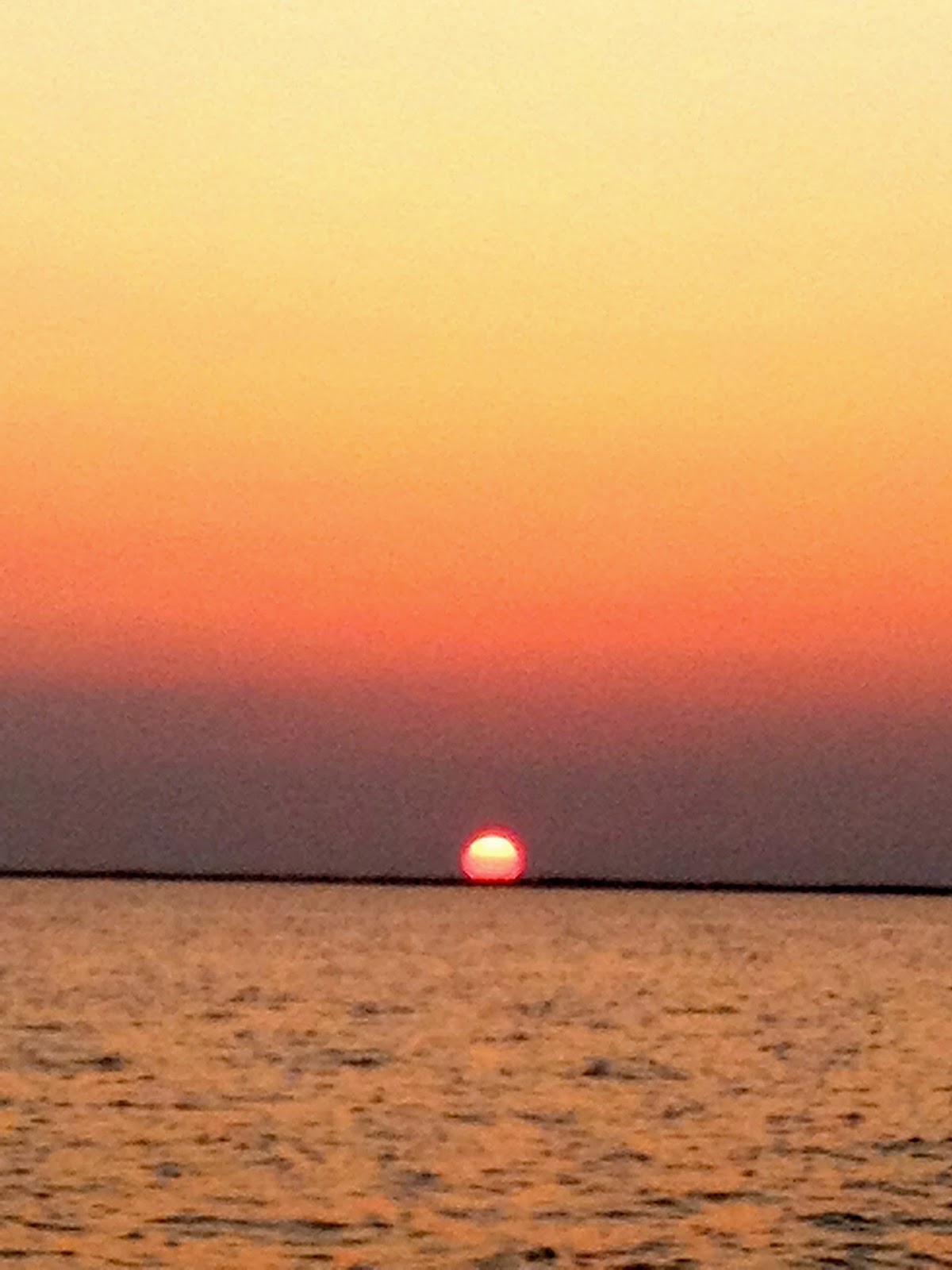

Sunset.


And Sunrise.

But, that's another issue.

Our ETA at City Marina in Charleston is 0100 on Tuesday morning.  We've been in and through Charleston quite a bit but arriving at dark (and tired) can be confusing and frustrating.  I've spent the morning looking at alternatives. Morehead City/Beaufort in North Carolina is the most likely Cruisers' alternative. But that's 250 NM from where we are now, meaning another night of two hour watches with the expectation of a night entrance there as well.

The Cape Fear River could work as well and is 100 miles closer, but that puts us [pause to watch flying fish] right into the ICW with fairly limited anchoring or service alternatives. Besides, we are due for a break.

So the plan is most likely to stick to Charleston.  Rest up and provision on Tuesday. And from there we are 470 Statute Miles to Norfolk. That means that a 70 SM day can be done in 10 hours at 6 knots. In short, even staying in the ICW gets us to Norfolk in six or seven days. We also have the option of going offshore again, but if the weather in the latter part of this week is bad, we can still make inside time. We can be on a plane to New Orleans as early as next Wednesday!

So, that's "a plan". Not yet "the plan", but something to work with.

[Added Tuesday morning, April 29]


Arrived at the Ashley River Anchorage off the Megadock in Charleston, South Carolina and dropped anchor at 0500.  Great day and evening on the water.  All is well.  We’ll see what a few solid hours of sleep does for our planning and future.