
Our Minim Creek Anchorage.

The calm before that THUMP!
Well past that now.
And it was an eventful day, as well. If Saturday was a day for long pants (the
first since January) and a winter coat (where was that stowed?), Sunday had
warm socks and hot oatmeal for breakfast added.
How do people survive in these frigid climates? It was 58 degrees when we got underway!
BRRRRRR!!
We did some pretty fast sailing in the Alligator River and
then again up the North River in howling winds as high as 26 knots. That helped us accomplish a lot of miles
before we anchored at about 5:45 PM.

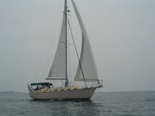
Sail Up and speeding along.
Even though we missed an Alligator Bridge opening by a mile
and a half, the most excellent of Bridge Tenders gave that a no never-mind and
opened for us as soon as we made it to the bridge. No bridge delay at all. That makes for a good day.

All of the Aids to Navigation host Osprey nests with baby chicks.
And who should we see in the Alligator River/Pungo River
Canal? Our friends from s/v Messenger?
s/v Autumn Borne? s/v Painkiller? s/v Last Boat? s/v ANYTHING? No, no, no, a
thousand times NO!
It was my arch nemesis.
ROYAL ENGINEER! Tug and
barge. Narrow canal. Again!!

Harmonic Convergence?
This time, I had a plan.
We cranked it up from 2800 RPMs to 3200 RPMs. We shook a bit. But we passed Royal Engineer without
incident.

Passing Lane.

You can't script this stuff.
And we kept that motor revved
up for the next twenty minutes in order to put distance between us. We did not see that monster again!

Until we meet again?
Blowing stink, as one would say, when we got to Buck
Island. But we were content. Anchored in 10 feet of water with 90 feet of
chain. Within inches of where we
anchored in October 2013 on the way back from the Bahamas. Let it blow.
Monday, May 5, 2014.
A business day. All
business.

Depth perception issues without contacts.
We have only 56 miles left to
reach our Mile Marker Zero destination.
But; .. and that’s a big BUT. We
cross into Virginia at Mile Marker 36 after crossing the narrow and blustery
Currituck Sound.
We then have the North Landing Bridge at Mile Marker 20 opening
on the Hour and Half Hour. No problem.
Next, we have the Centerville Turnpike Bridge at Mile Marker
15 opening on the Hour and Half Hour.
That’s five mile for us to make in 30 minutes. A tough slog for which I planned to use my
Royal Engineer stratagem (3200 RPMs).
But,… we are immediately foiled by a Montreal Motoryacht that apparently
takes “no wake” seriously as they virtually stop as they move through the
bridge and for the next what?! Mile?? We
are delayed a half hour at the Centerville Turnpike Bridge.
The Great Bridge Bridge (no typo there) is at Mile Marker
12. Only three miles away and opening
only on the Hour. We make it by jumping
ahead of m/y Montreal. Other sailboats
in our line (four or five by now) have also caught on and pass this rule
follower.
We make it into the Great Bridge Lock at Mile Marker 11.5
ahead of the pack. That means we can run
to the Steel Bridge at Mile Marker 8.8 to make the next on the Hour
opening? No such luck. A bridge delay again.
Tess calls the last bridge.
The notorious Gilmerton Bridge.
Well known for being in the closed position from 6:30 AM to 9:30 AM and
again from 3:30 PM to 5:30 PM. Talk
about bridge delays!! Tess’
question? Can you confirm that you have
a 4:00 opening as well as a 3:30 opening?
We know the answer. No. It’s 3:30 or 5:30. It’s Mile Marker 5.8. Only three miles, but since we left the Great
Bridge Lock we are now in Virginia Tidewaters.
That means, we are fighting a real tide again. Yikes!
Royal Engineer stratagem.
We outrun the pack. We make the
Gilmerton with four minutes to spare! We
are good. We are there.
We mosey down the Elizabeth River. Norfolk on one side. Portsmouth on the other. The rain starts. The wind picks up. But, we are almost there. Tidewater Yacht Marina. Portsmouth, Virginia. Mile Marker Zero. Slip F24 (only three slips in from the end). No problem.
Problem. With the
wind pushing the bow one way and the current pushing the stern the other, I
miss the turn into the slip. Back and
fill. Back and fill. Back and fill. No progress.
Head down the slipway and make (or try to make) a turn. Again.
Back and fill. Back and
fill. Back and fill. Finally!
This time, heading into both the wind and current, we slide
into F24. Only one post bumped. But that’s what they are for.
We are fried.
Frazzled. But safely
ensconced. 1,200 plus miles in nine
days. But, home. Or close enough to feel like home.
No comments:
Post a Comment